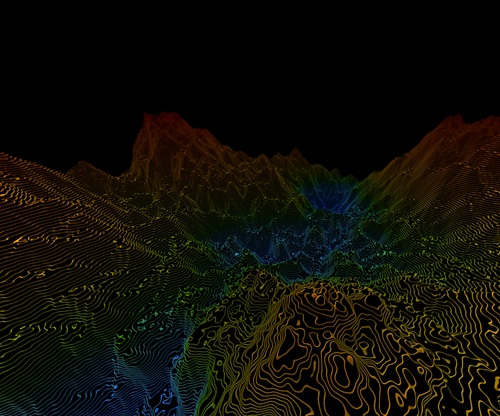
LiDAR Data Services
We specialize in LiDAR data processing, delivering precise classification of ground, vegetation, buildings, and infrastructure. Our team converts raw point clouds into detailed digital terrain models (DTM), surface models (DSM), and contours. We support industries like utilities, urban planning, and forestry with accurate 3D models and corridor mapping for powerlines and infrastructure.

Drone & Aerial Imagery Processing
Using drone and aerial imagery, we generate high-resolution orthomosaics, elevation models, and vegetation indices (NDVI, NDRE). Our services turn raw image data into spatially accurate, analysis-ready maps that support agriculture, land development, and environmental monitoring. Whether for terrain modeling or crop analysis, we ensure your imagery delivers insight.
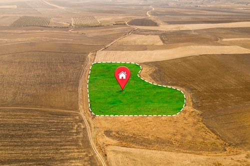
Cadastral & Land Parcel Mapping
We provide cadastral mapping services that support land administration, property boundary delineation, and legal land records. Our workflows integrate satellite imagery, drone data, and survey inputs to produce precise land parcel maps, aiding urban development, taxation, land registration, and dispute resolution.

Agricultural Mapping & Analysis
We use geospatial tools to support crop monitoring, soil classification, and yield analysis. Our services include vegetation indices, soil mapping, and farm zoning — helping farmers and agronomists make data-driven decisions that enhance productivity and sustainability.
Utility Corridor & Powerline Mapping
We offer detailed LiDAR and GIS-based mapping for powerlines, pipelines, and utility corridors. Our services support right-of-way planning, vegetation clearance analysis, and infrastructure maintenance using high-resolution terrain and classification data.